
A strenuous and spectacular circular route taking in one of the Lake District’s iconic peaks
Distance: 5/6 miles
Time: 3 to 4 hours
One of the slight frustrations of hill walking is that you rarely see where you are going.
I don’t mean that literally (unless, of course, you are heading uphill in the middle of the night).
It’s just that you can rarely see the summit or peak of the mountain you plan to climb from your starting point. Anyone who’s been up Helvellyn or Scarfell Pike will know what I’m talking about. Their peaks seem invisible and don’t reveal themselves until you have almost reached the top.
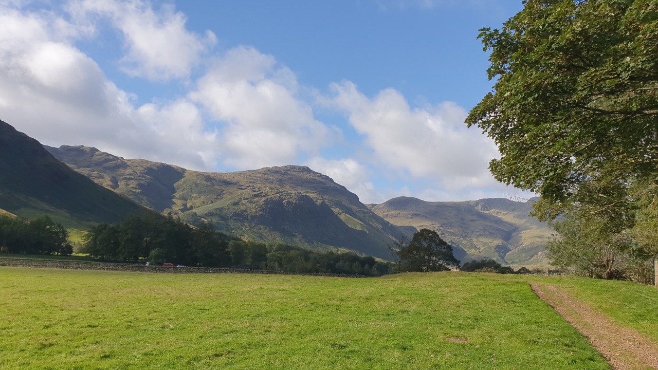
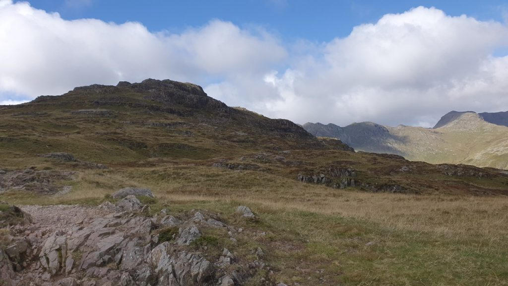
With Pike of Blisco (or Pike o’ Blisco) that’s not the case. The summit is on constant display. Heading down Great Langdale, it’s there on the left just before Great Knot and Crinkle Crags at the end of the Valley. It’s peering down on you, challenging you to take it on.
So you do.
We started from the Stickle Barn car park, next to the New Dungeon Ghyll. Alternatively, you can begin your trek from the Old Dungeon Ghyll. It makes little difference.
Either way, follow the road (B5343) until it meets a farm road which invites you further down the valley. Don’t take up the invitation. Take a sharp left and follow the sign for the Great Langdale campsite.
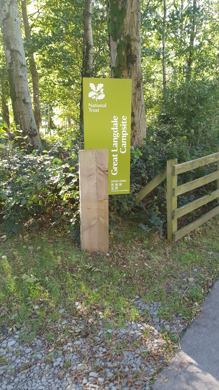
Soon this road will fork. You can take the right fork and follow the road up Side Peak or cover the same ground ‘off road’ by bearing left and walking through the campsite.
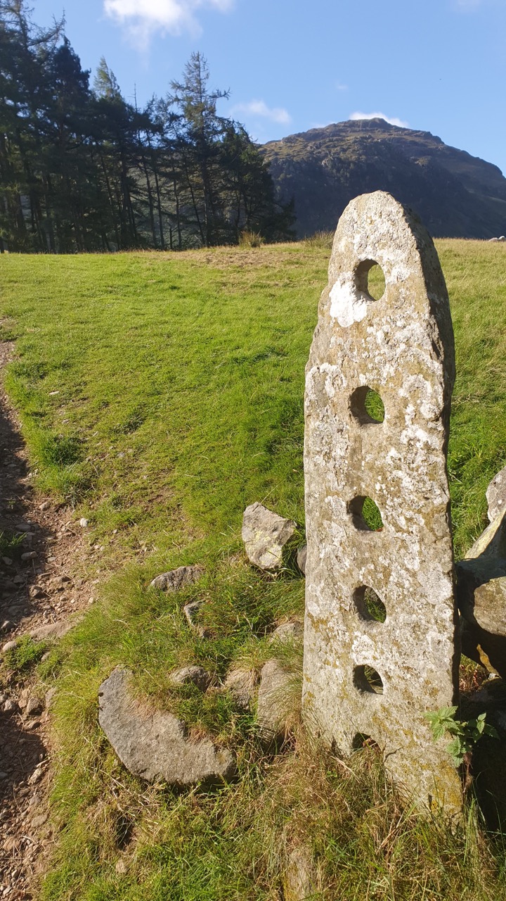
We did the latter. At the far end of the campsite there’s a wooden gate. Pass through it and then cross a field marked by a gate post that looks centenaries old.
You then follow a path up the hill. For about ten minutes your legs are tested with a sharp climb. Soon you reach another wooden gate that leads you back onto the road.
At this point, turn right and head downhill for a hundred metres or so. Soon you will see the path up the Pike of Blisco on your left.
The path takes you back and behind a peak called Kettle Crag. It’s a fairly direct route to the summit. And that means one thing: it’s a pretty brutal ascent.
It feels like a long slog as you climb the mountain’s east face. It’s less of a path, and more like a never-ending staircase.
Your legs and lungs demand that they pause for a breather. As you do, you look around, back down Great Langdale valley and realise that, in a relatively short period, you’ve gained a lot of height.
That spurns you on and motivates you to reach further up the hill.
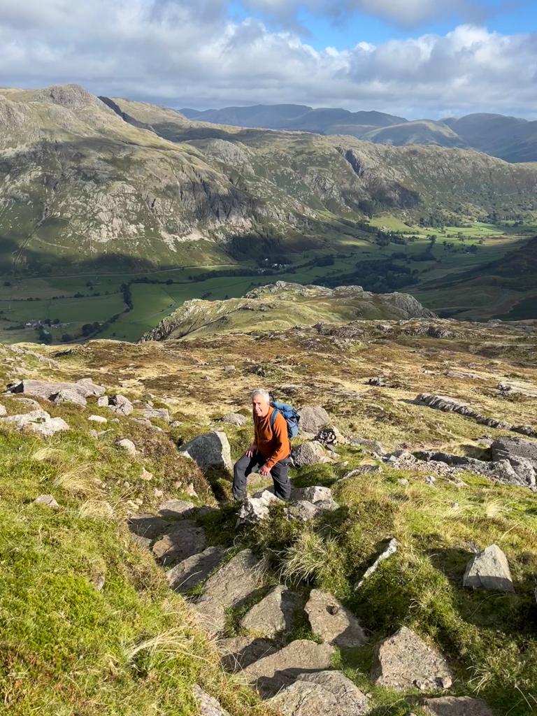
After around 45 minutes the staircased path blurs into the side of the mountain. You can still see cairns tracing your route to the top but now you have to pick your way and scramble over steeped rocks.
After a couple of false summits, you reach the top.
And what a treat it offers…superb views in all directions.
Directly south you see the ridged outline of Wetherlam. The tip of Windermere can be spotted to the east. Directly to the west are the ridges of Great Knot and Crinkle Crags. Then you see the giant lump of a rock that is Bow Fell and its cousin Great Tongue. And behind the verdant valley below you see the distinctive outline of the Langdale Pikes.
It’s a tremendous 360 degree view. It’s breath-taking.
We did not stay too long on the Pike of Blisco’s summit. It was too cold and windy.
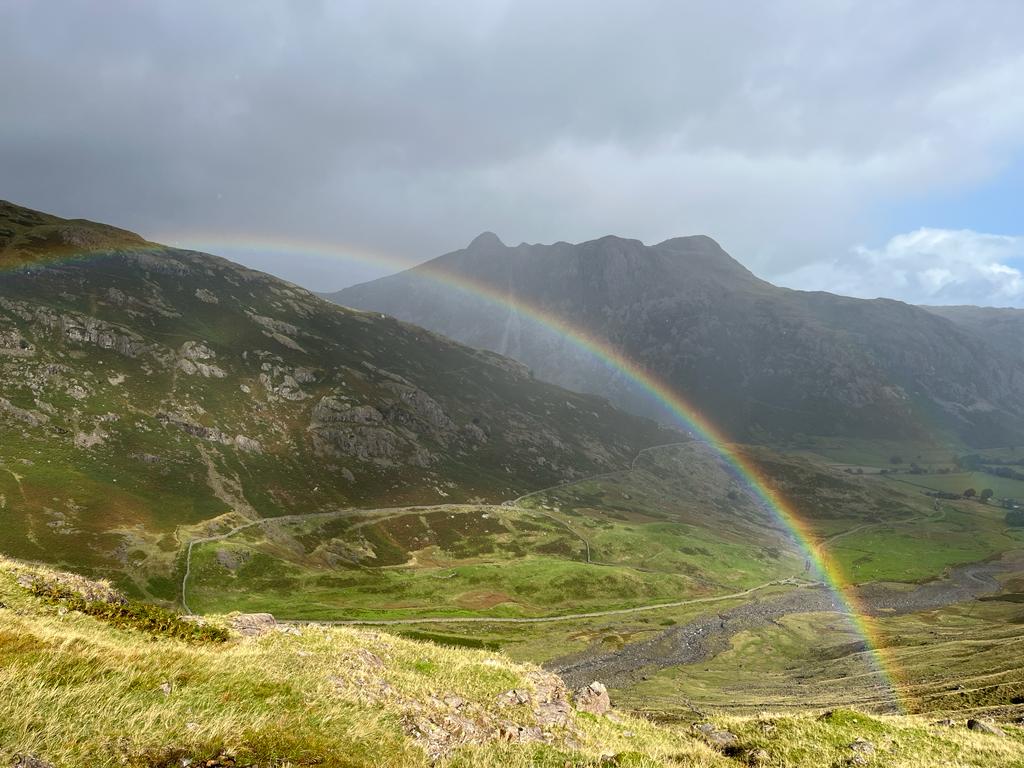
The path down led south-westwards and is easy to find and follow.
Losing ground quickly it takes 20 minutes or so to reach a T junction. There the path ahead leads up Great Knot. Instead, turn right and follow the paved path that stays tight to the side of Pike of Blisco as it slowly leads you down towards Oxendale Beck.
It’s further than you think. This reminds you just how far you climbed earlier to reach the summit. On our descent the paving stones were reddened by spitting rain. It was easy to slip as the wet stones seemed to shorten and slope downloads.
The sun behind us cut through the rain to arc a rainbow to treat our descent.
Eventually we reach a wooden bridge over Oxendale Beck.
Picture eleven: Back in the valley looking up at Pike of Blisco
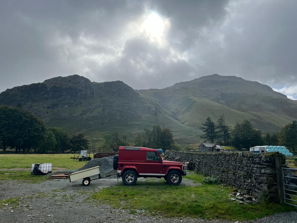
The path then levels as the valley opens up. The walk then passes through a farmyard and then down through the valley back to the Stickle Barn car park.
Some ideas for nearby walks might be;