The Langdale Horseshoe is a superb circular walk from the Old Dungeon Ghyll Hotel taking in the Langdale Pikes, Bowfell and the Crinkle Crags. Approximately 12 miles … It’s quite challenging and it took us about 8 hours.
At the back of the famous Old Dungeon Ghyll Hotel bare left and follow the sign to the footpath. Immediately after the gate turn right. The path then takes you behind a white house.
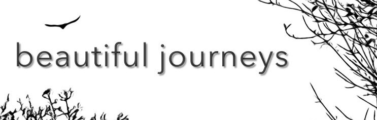
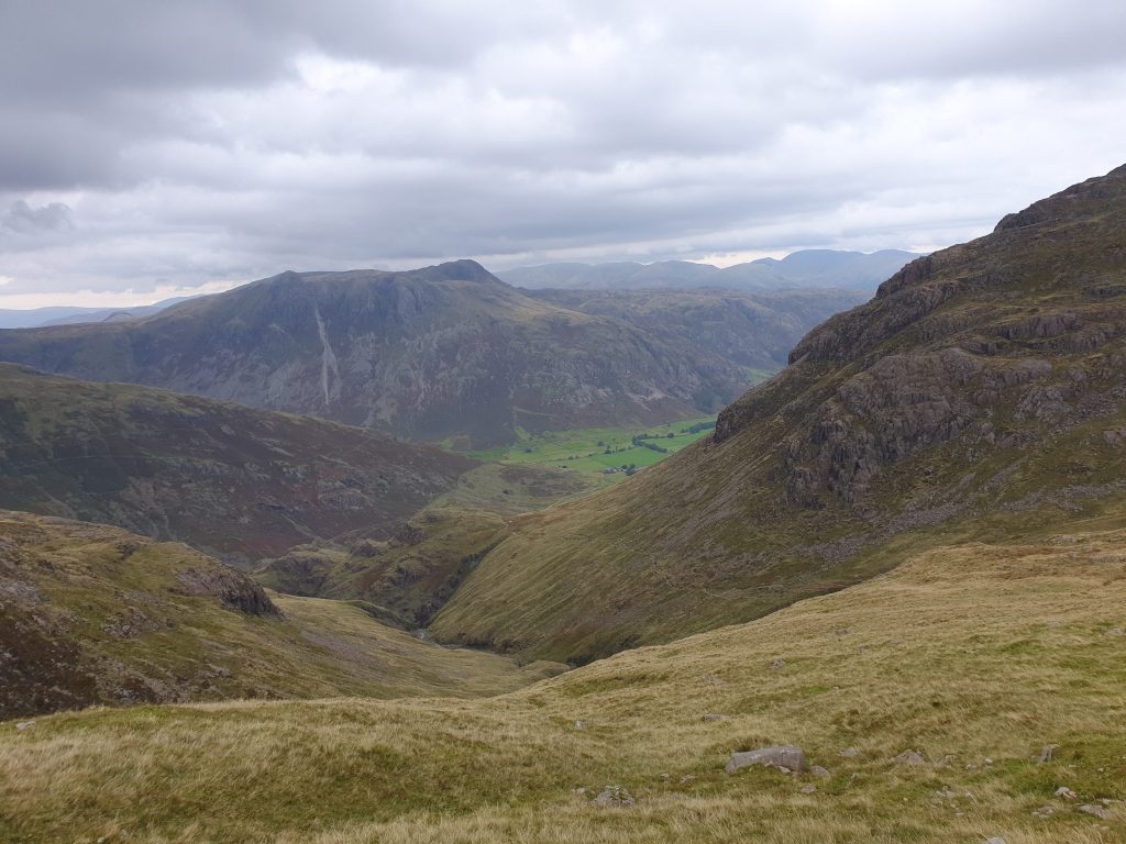
For about half a mile the path hugs the side of Raven Crag, the hillside that reaches up to your left. Behind you is a great view of your destination later in the day: the Crinkle Crags and Great Knott at the end of the Langdale Valley.
After crossing a wooden footbridge take the left fork.
As you begin to gain height, be careful not to follow the path to the left. Instead, continue straight up. You can now hear and see the water of Stickle Ghyll, tumbling and gushing downwards.
You are now climbing towards Stickle Tarn. It’s hard work as the route is direct and steep. It feels as if you are walking on a never-ending staircase. Your legs and lungs tire as you feel the strain.

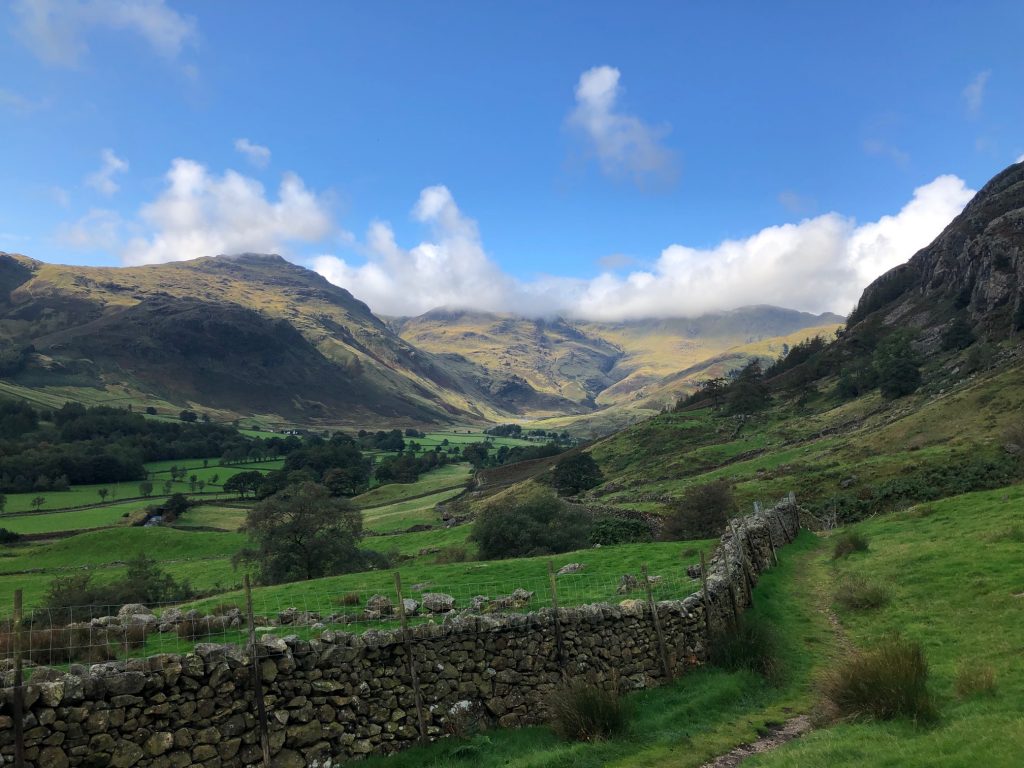
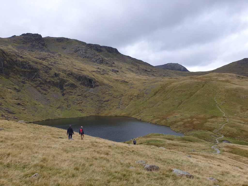
Eventually you reach the top, where you are struck by the magnificence of Harrison Stickle and Pavey Ark, a jagged mass of rock that you see in front of you.
The water of Stickle Tarn lies tranquil, in stark contrast to the crashing turbulence it will soon experience when it hurtles down the hillside.

You cross the Ghyll and choose the path that follows the right shoreline of the tarn.
When the path leaves the shoreline there are three options in front of you. Take the left-hand route that leads upwards around the back of Easy Gully.
You now follow the path westwards. You are just behind the ridge of the Langdale Pikes. You can deviate slightly to climb boulders to see over the ridge edge. You appreciate the sheer drop down to the valley below.
Navigation here can get a bit tricky. The terrain is a little boggy as you veer right in a north west direction. Avoid the path directly northwards that leads up the spine of High Raise. Instead pick out the path that crosses Martcragg Moor and then ducks down to meet up with the Cumbrian Way.
As you meet the Cumbrian Way, you’ll see a small tarn. At this point there’s a confluence of different paths leading in different directions. Take the one to the left.
Your walk is now quite heavy and laboured as you climb towards Angle Tarn, a picturesque sunken pool that’s hidden from your view until suddenly it’s there in front of you.
At the tarn bare right and begin to climb steeply.
You now have a choice. You can continue on this path if you want to head towards Great End and ascend Esk Pike from the other side. We chose a more direct route, turning left and heading for Ore Gap, the gully between Esk Pike and Bow Fell.
From Ore Gap, follow the path to the left and begin to climb Bow Fell. At the top you are rewarded with magnificent views. You can now see directly down the Langdale Valley with the first of the Langdale Pikes, a massive slap of a rockface called Pike of Stickle jutting out impressively.
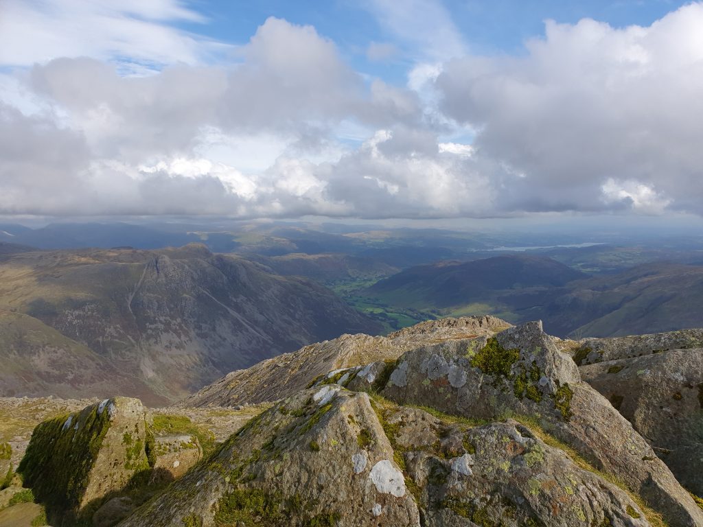
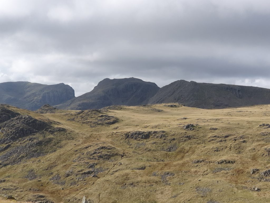
Turn one hundred and eighty degrees and look in the other direction. You can see the three promontories of Sca Fell, Scafell Pike and Ill Crag all in a line in front of you.
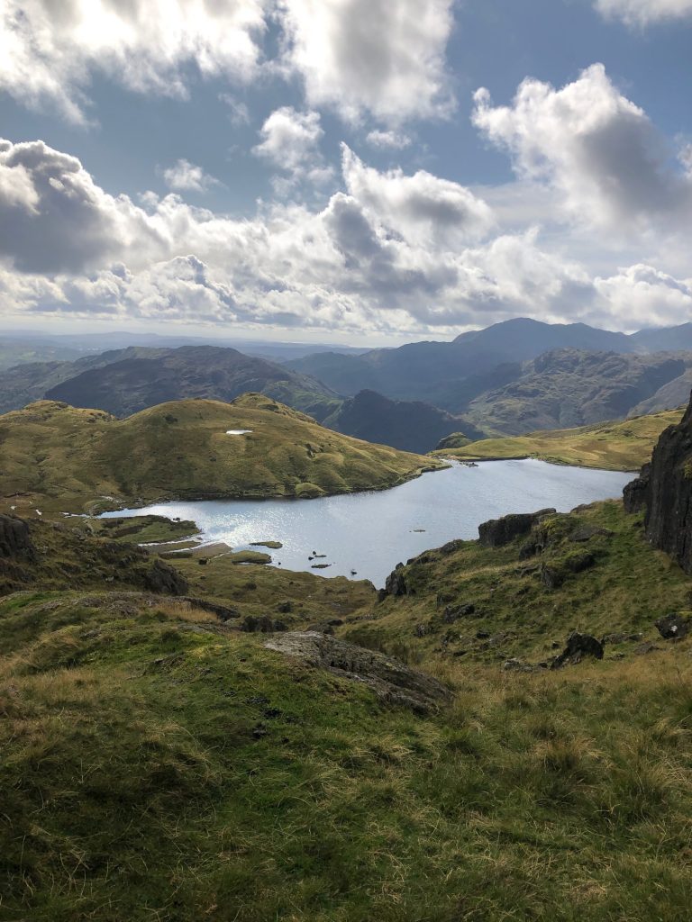
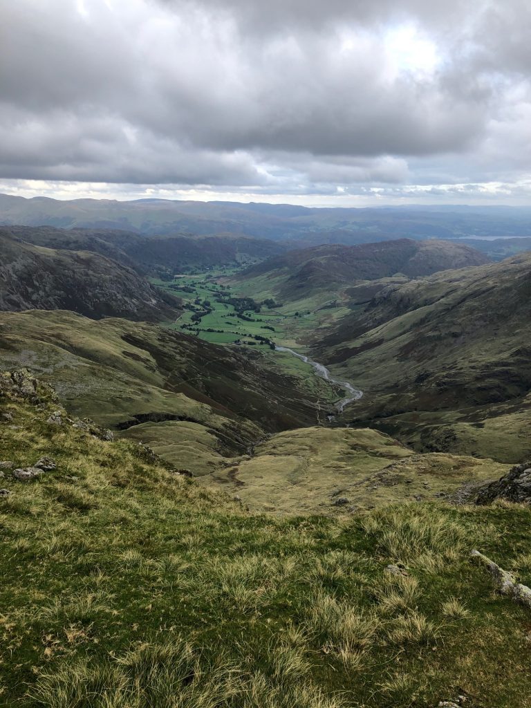
Your climb up Bow Fell has been steady although not brutal. You only realise how high you’re climbed when you start your descent. You lose height quickly as you follow the stepped pathway to an area called Three Tarns, the gap between Bow Fell and the Crinkle Crags.
These Crags that sit proudly at the end of the Langdale Valley may have a childlike name. But there’s nothing childlike about their contours or the path you will take. You now venture on a series of scrambles up and over these Crags. It’s fun and exhilarating, although care needs to be taken to ensure your feet don’t slip.
It’s arduous work and it takes time to pass through all the Crinkle Crags. You only realise that you have done so when the terrain softens and there’s an extended gap before the next peak.
This peak is Great Knott, a huge fist of rock. We were now thinking about heading back down into the valley, but stayed to the left of Great Knott, walking around the back of it.
The final large peak of the Langdale Valley is elaboratively called the Pike of Blisco. With tiring limbs, it looks a brut. You can either follow the path in front of you and go up and over the top of it, or – as we chose – turn left and begin a long, slow, stepped descent to the valley below.
Eventually the path bottoms out and you reach Oxendale Beck. Cross over the front path and turn right. You are now heading back down the Valley.
After passing through a farmyard the track becomes a tarmacked road, carry on and you soon find yourself back at the Old Dungeon Ghyll, where the day began.
If you are staying longer in the area there are so many wonderful walks nearby.
Some ideas might be;